Monday, May 28, 2007

The Paw Paw Tunnel

Flashlight, hiking boots, or both.

Start Mile: 154.8
End Mile: 156.4
Time: 3 hours
When: Afternoon

Directions: From Berkeley Springs, take WV 9 west to Paw Paw. Make sure to stop and enoy the view at the overlook along the way. Before you get to Paw Paw, 9 will oin 29. Rt 9 turns into rt 51 at Paw Paw. There is a boat lanch on the WV side of the river. There is a parking area for the C&O Canal Park on the right once you cross into Maryland.


We decided to go for a hike on Memorial Day afternoon. It had been over ten years since we had been to Paw Paw so we decided to go to the Paw Paw Tunnel.


There is a path down to the river at the parking area for canoes.


The superintendent's house still stands across the field from the parking area.


The Western Maryland Railroad crosses the Potomac once again where the path from the parking area meets the Towpath.


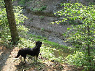
There is a camping area before the tunnel where Buck played in the water by this pump.


At this point, the canal is much higher than the river.


The south side of the tunnel is impressive.


The tunnel does not seem that long when you enter it but it is three fifths of a mile long. You will not be able to see without a flashlight.


The north side of the tunnel has a boardwalk alongside the canal.


Just what are you looking at?


Those are iron bars drilled into the shale to stabilize the excavated wall leading to the tunnel.


There are springs along the path before the Tunnel Hill Trail.


The Tunnel Hill Trail is two miles of hiking over the mountain. I was hurting pretty bad at this point so we headed back to the truck.

Read more...

Saturday, April 28, 2007

East of Hancock

Starting to explore the Hancock area

Start Mile: 121
End Mile: 122.9
Time: 1 hour 40 minutes
When: Afternoon

Directions: Take Interstate 70 to Hancock, MD. Make a right toward Hancock onto 144. Make an immeadiate right into the maintenance drive for the C&O Canal.


I finally had a day that I felt like getting out. I wanted to go someplace that we have not been before. While I've stopped at the Park and Dine in Hancock before, I've never explored the town. I thought it would be fun to start at the eastern part of town and work our way west.


To get to the parking area, you need to cross the Western Maryland Rail-Trail. There is always a lot of bike traffic there so I don't know if we will be able to explore it some time.


Between the parking lot and the towpath sits this once impressive house. Does the Park Service own this?


Lock 52 sits just to the west of the entry to towpath. We will try that direction next trip.


The Potomac was high and fast. It is hard to tell just how fast the river was from this picture.


Buck likes to sample the various plants on our walks. He was particularly interested in the Blue Bells. Unlike the various grasses, all he did was sniff the flowers.


At Lock 51 there is what's left of a lock house. It is interesting to see how these were built. It is also interesting to see how something so substantial could deteriorate in such a relatively short time. Notice how the towpath actually has a hill at the lock.


Not far from the lock is a culvert. Canals are not like streets, when the canal crossed a small stream it had to be eleveted allowing water to flow under it. This is important for water management.


Not much further is another culvert. This one has a provision for adjusting the water in the canal called a waste weir.


Blue Bells do well in shady areas and tend to thrive in forests. This part of the canal has tons of them.


People leave pennies on certain mile markers for luck. I bet this drives the forest service nuts.


Buck found this turtle. I waited a while for him to recover from being licked by the dog and come out of his shell.


There is another culvert not far from the mile marker. Notice that all of the surface water in Maryland farm country enters the Potomac at these culverts to be picked up down stream by water systems for suburban MD and WV.


Buck found another turtle that was watching people pass on the tow path.


Buck hams it up by marker 121.


This is the west side of Little Pool. You can see that Interstate 70 is not far.

Read more...

Tuesday, April 3, 2007

Conococheague Aqueduct

Starting over in Williamsport

Start Mile: 99.5
End Mile: 101
Time: 50 minutes
When: Morning


Directions: Where route 11 crosses the Potomac is Williamsport. Right off of 11 is a visitor's center with plenty of parking.


This was my first trip to the river after my foot surgery. My wife and I wanted to get out of the house as the weather finally improved. We decided to go to Williamsport and see how high the water had risen after the week's storms.


The water at the basin didn’t seem that high, but the Potomac had come up enough to cover some of the ground around the soccer fields. We walked across the top of the aqueduct so we could see across the river.


Conococheague Creek had risen a bit too. There was quite a bit of debris flowing into the Potomac. This is a good spot to fish from shore. The side of the aqueduct was broken out in 1920 by a canal boat. The repairs were temporary as the side is missing now.


This is also the place where the Confederates retreated across the Potomac after the battle of Gettysburg.

As we headed west on the tow path, we could see that the water in the canal was still frozen. This section of the canal is over grown.


Mile marker 101 is not far from the parking lot. Buck had to be convinced to sit for a picture. He wanted to mark the mile post as well as every tree.


The power lines are near Jordan Junction. We turned around here. With the trees so think around the canal, the power line right of way provides a good view of the West Virginia side of the river.


Williamsport is a step back in time. Route 11 runs though the center of town on its way to West Virginia from Hagerstown. Once you are south of the interchange with I81, there are interesting older houses on both sides. Night life is nonexistent so come early and enjoy a small town day.

Read more...

Monday, January 1, 2007

Some years are better than others...

...or, I got foot surgery for Christmas


Some things are not meant to be. Me exploring the C&O Canal last year was one of them.

I started having problems early in the year but I thought I could deal with the pain. I was born with flat feet so foot pain is nothing new. I had to have corrective surgery in October 2002 to eliminate bone build up on the top of my right foot. It was back with a vengeance.

The first attempt to deal with the problem was simply a new set of orthodics. Because insurance would not cover them, my doctor tried an air cast that was covered. This was a waste of time for the insurance company. I bought new orthodics after two weeks. This provided temporary relief.

A month later my foot pain stared getting worse. It started altering the way I walked which caused pain in my ankles, knees, and hips. My doctor recommended a radical rebuild of my foot. I started getting other opinions.

At this point I could barely make it up the stairs. No problem because I avoided them as I couldn't get back down. I found a new doctor that wanted to try less invasive measures before permanently altering my foot. I didn't need to be talked into it.

First, I started on a new anti-inflammatory. That helped a bit but I still had foot pain. I needed to have the bones in my foot ground down again. On December 1st I had the operation. The recovery is going well and I should be fully ambulatory soon.

Buck is tired of the excuses and wants to get back to the river. I hope to start our adventures again in February.

Read more...